Back from another fantastic road trip, and I never even got through the first one from last year. Here are our travel notes from my Samsung tablet illustrated with a few of the many pictures we took of all the fabulous things we saw along the way. Hard to know where to stop adding photos.
Left home 2.24pm. Sunday 5.12.2013.
Arrived Donner rest area 4.15
 |
| Odd structure off Interstate 80 in Nevada |
Gas at lovelock about 6.35. Dinner in
winnemuca at a local pizza joint. Several unrelated tables of men busy getting drunk and loud. Took about 45 min. Called oak tree inn in
Elko and made reservation. Heading to
elko at 8.40 pm. Arrived elko around
10.20pm. King bed 80 dollars. Note that if we had reserved the room online it would have been cheaper, but they wouldn't give us the online rate at the desk and we were too tired to go elsewhere. Ted complained about the bed the next morning, but I slept pretty well.
Monday. 5.13.2013
Leave Elko 9 am, 65 F, mile 440. Heading to
city of rocks national preserve.
10.26 am 75F left Wells after eating breakfast
in city park, also topped off gas.
Left I80 at Oasis. Took Hwy 233/ Utah 30 to northeast. Drove across on north side of Great Salt Lake on Utah 30 to intersection with 42. Went west on 42. Became Idaho81 at state line, turned due west at Bridge, across several of miles of dirt roads till we got to City of Rocks. Visitor Center is at Almo, should have gone there first, too late by time we left City of Rocks.
 |
| Looking more or less south towards Great Salt Lake from Utah 30 at intersection with road to Kelton. |
Only
had time to visit the Circle Creek overlook and take a loop hike on the
GeoWatt Trail, connecting to the Stripe Rock Loop Trail. Really pretty
and interesting. I would love to see more of the preserve.
Left city of rocks 4.30 pm miles 670.
 |
| Upper Raft River Valley from Circle Creek overlook in City of Rocks National Preserve. |
 |
| Along GeoWatt Trail City of Rocks National Preserve |
 |
| Along GeoWatt Trail City of Rocks National Preserve |
Tues 5.14.2013
Left Idaho falls 9.20 mile 837, 62F.
Stayed
best western driftwood nr river. Room
nice, but 100 bucks.
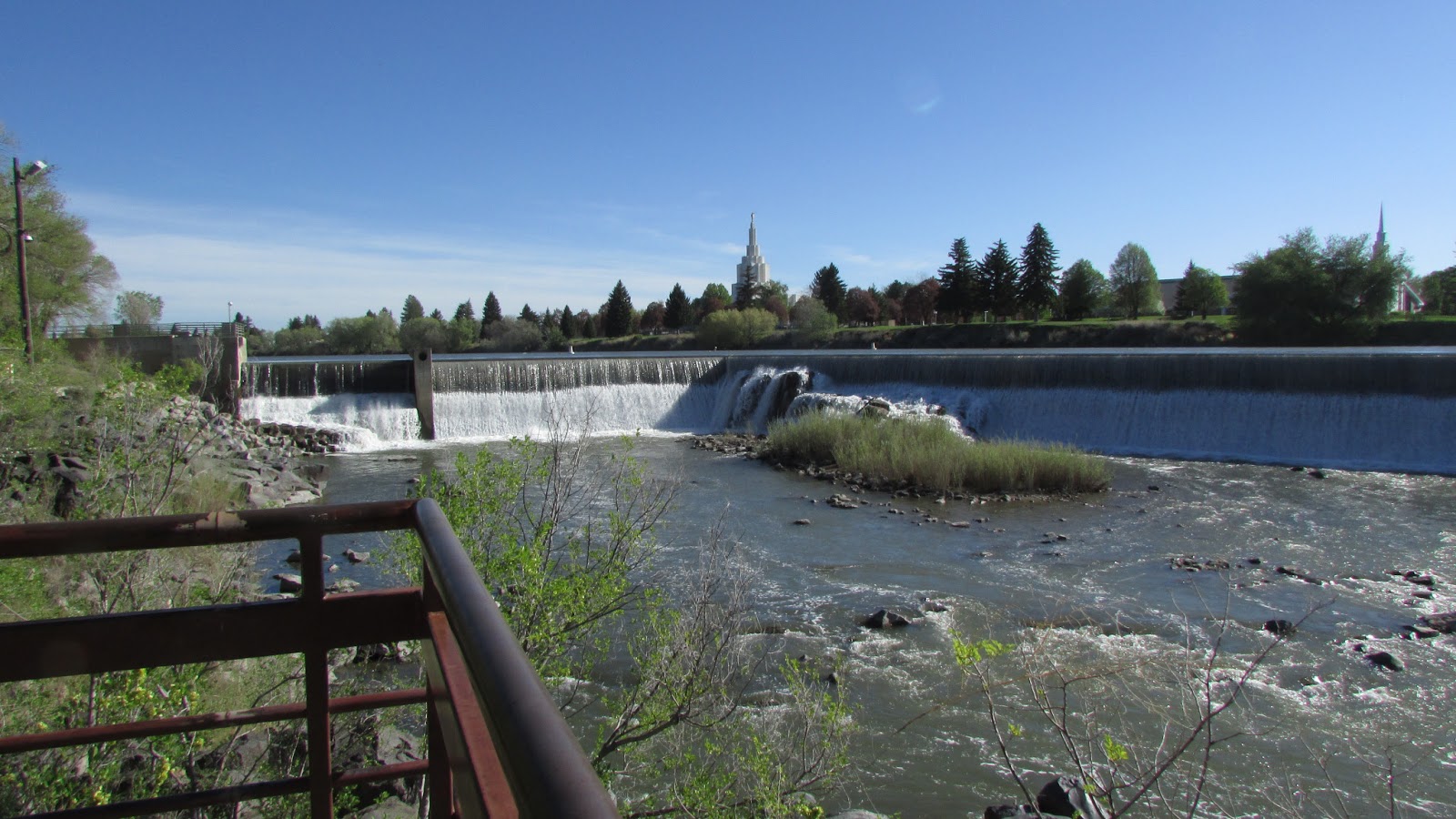 |
| Idaho Falls, apparently converted to a hydroelectric project many years ago. Nice riverwalk trail as part of upgrade in the 80's. |
Prev day got to city of rocks at 1.30pm ate
lunch took loop hike. Left 4.30 pm as noted above. Drove to pocatello with short
stop at register rock site.
Ate at questionable taqueria but no ill effects.
Stopped at fred meyer for salad fixings then got gas. Much indecision and time
spent dinking around resulted in decision to head to Yellowstone nw entrance
rather than try for Fossil Butte nm. Got
to idaho falls around 9.30pm. Some indecision as to room.
Arrived YNP from West Yellowstone
entrance, Hwy 20. Drive into park is along Madison
River. Very pretty. Stopped at a small thermal, a waterfall, the Norris geyser
basin, mammoth hot springs. Leaving plateau through golden gate
spectacular.
 |
| Norris Geyser Basin, Porcelain Basin |
 |
| All entrances and exits from the Yellowstone Plateau are fantastic. This is the Golden Gate. |
 |
| We were shocked by Mammoth Hot Springs. Most of it is inactive and gray, but the few small areas that are active are very interesting and colorful. |
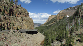
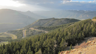
Exited park from northeast entrance,through Silver Gate and Cooke City, Montana. It was really snowy up there. We went through Colter Pass and connected to Wyoming 296 aka Chief Joseph
Scenic Byway. This drive was spectacular!! The scenery was amazing. The route was more or less deserted at that hour of the evening.
 |
| We stopped at a scenic overlook to photograph the amazing mountains we were driving into, and were surprised when we looked back at the way we had come to see these towering peaks. How fun it would be to drive into the park through this entrance. The tall spikey peak is Pilot Peak, elevation 11,708. |
 |
| Some of Chief Joseph Scenic Byway. |
Arrived Cody 8.30 pm. Ate at Wyoming barbeque and
chophouse. Slept at Holiday Inn Express, most expensive room of the trip I think, will have to check.
Weds 5.15.2013
mileage 1119 9.15 am 59F.
Leaving Cody on hwy 120 towards Thermopolis.
1164 miles breakfast at very nice
wayside, On road again at 10.45 am.
Found nice small badlands along Hwy 431.
 |
Nice badlands along Hwy 431,
This wasn't marked on any map, but was signed and had a nice trail. |
No trail guides and so we didn't hike
there which might have been a mistake because we didn't hike all day. Just
drove. Drove through Bighorn Mtns on Hwy 16 east
through Ten Sleep Canyon. Thought not as spectacular as rt 14 to the north that we took
last year.
 |
| Our lunch spot had a gorgeous view. We snapped a photo of a couple that stopped while we were eating and they returned the favor. |
Went into Custer SD, bought dinner at Quiznos. Drove up to Wind Cave NP eating dinner as we drove. Planned to camp but campground was closed! boo hoo. Was deja vu all over again as we
ended up driving out of the Black Hills at dark under cloudy skies threatening
rain. Just like last year! In Custer SP saw a very large bull elk posing on
outcrop for phtographer. We thought about camping but it is so complicated now. No place to self register. Very confusing. Touring Wind Cave would probably be a very nice thing to do, might have to try that another time.
 |
| Saw so many pronghorns on this trip, also buffalo, a few bighorned sheep (in YNP), bears, prairie dogs, elk, and many birds. These are at Custer State Park. |
Thursday 5.16.2013
1556 mi 8.25 am 70F
Left Best Western in
Rapid City on Rushmore Ave. Stopped downtown to look at some of the presidents and high-five Jimmy Carter. Drove through rain. Overcast and slightly misty by time we reached Badlands NP. Drove into eastern entrance from Cactus Flats since we were pressed for time.
Ate beakfast in
pullout, hiked Door Trail, Cliff Trail
Nature Trail, also Saddle Pass Trail, which was very steep, up to junction on
Castle Trail, partway along Castle
Trail to left.
 |
| Some colorful locoweed? on the Castle Trail. |
 |
| Saddle Pass Trail is very steep! |
Exited Badlands 1.12 pm, mileage 1648.
Got gas Mitchell SD, was most expensive gas
of trip to date by about 94 cents compared to the cheapest gas we got in Rapid
City.
Went for walk Luverne, MN on biketrail had dinner at Pizza Ranch.
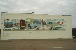 |
| Love this mural! Luverne MN |
Reached AlbertLea 10.40 pm about, stayed in
country inn and suites.
Friday 5.17.2013
Left 2090 mi 57f, 8.50 am
 |
| Breakfast at park in Faribault, MN, only second scarlet tanager I've ever seen! |
Lunch w Barb M Chippewa Falls, mileage2280, arrived
about 12.45pm, left about 3.30pm.
 |
| Me and Barb in Whitney's new house |
In pe 6.07pm, mileage 2386, 57F
Had a great turkey dinner prepared by
granddad
 |
| My hero! |
Dad feeds peanut treat, c&s, made in usa.
Stayed in PE several days to work on Dad's garden, he went into hospital feeling unwell early morning Tues, but checked out OK and was released in the evening.
Loon Lookout 2562 miles, 4 pm, 51 F, Weds May 22.
EXPENSES for the 2 of us
Gas $313.18
Hotels $456.14
Food $206.82
 |
| Dad and I watched this cute little sparrow creeping around in the grass one morning, finally decided it was a Savannah Sparrow |
 |
| Eric came a couple of days after us and stayed an additional week after we left. |
 |
| Taken from the boat on our Loon Ranger expedition, saw no nesting pairs and no territorial pairs either. Extremely disappointing. |
 |
| Got up at 5 am to capture the sunrise. Took about a million pictures trying to capture it properly. |
Return trip. Left Trout Lake Sunday morn May 26, temperature 60 F,
odometer 43491, trip odometer 0.
Switch driver to EB and get gas at Edgar
Cenex, 91 mi, 62 F, 11.22 am
Saw some Amish crossing hwy about 12.15
Stopped Mennominie rest stop 1.15 pm driver
switch 190 miles
2.00 pm stopped for lunch at Dinos in Woodbury,
guessing was about 245 mi, 58F. lunch
took about 35 min, then back on road. 35E was closed at some point so we had to
go to 35W, then S on 35 to Albert Lea, where turned W onto I90, headed for
Pipestone N M.
Stopped at rest stop north Albert Lea, nice
sidewalk through woods, saw jack in the pulpits, ted takes over driving about 4.15pm.
Needed gas and driver change so stopped
briefly at Sherburn exit.
Gas was pricey, so only put in 3 gal. 5.50,
about 420 mi, 54F, gray dim and misty.
Wanted
to go to Pipestone n m, but at Luverne where filled tank at Shell station began to pour, continued on
to Souix
Falls, SD dinner at Pizza Ranch. Not as good as the one in Luvernne, MN, seemed
to be adverse to putting vegies on the pizzas. Ted thought the salad
bar was better though I did not. Shopped at Hy Vee. Continued to
Mitchell, SD, spent night at Best Western, got in about 10.10 pm.
Monday 5.27.2013
591 miles Left Mitchell SD 8.30 am, , temp
60F.
Mi 659 left
10.40 am 67F after stop for breakfast at rest stop on Missouri river at
Chamberlain, Lewis and Clark interpretive center and overlook nice, but area
reeked of diesel fumes from idling trucks. Stop probably took close to 1 hr, but
did walk about a bit and looked af exhibits
 |
| Chamberlain rest stop on I-90, Missouri River in background. |
 |
| South Dakotans have fun with dinosaurs and skeletons... |
Drove to Gordon NE,and ate lunch in same
park as last year. Then drove to Scotts Bluff,
stopping at Carhenge in Alliance, NE. Were severe
thunderstorms we skirted to N of as we drove between Alliance and Scotts
Bluff.
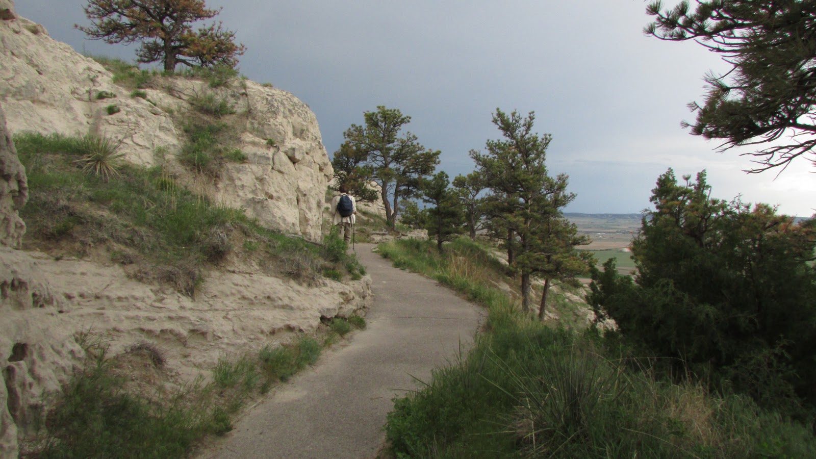
At Scotts Bluff, time change,
arrived w enough time to tour visitor center about 4.15. Then took lovely 3.2
mile round trip hike to top of bluff. got back down about 6 p.m.
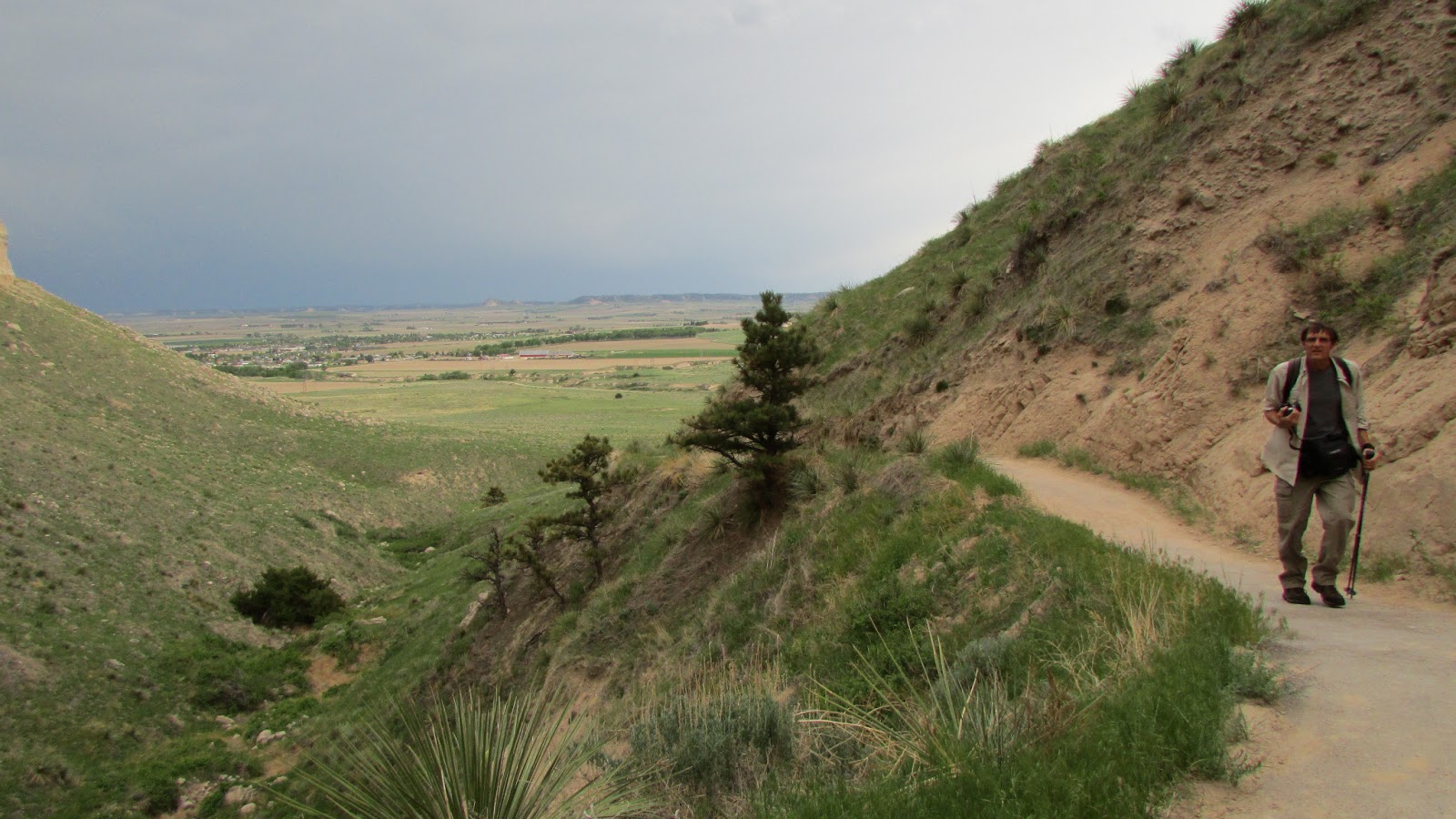 |
| On Saddle Rock Trail |
 |
| On Saddle Rock Trail |
Now on way to Cheyenne via 88 and
la grange wy. Dinner Cheyenne, Chipotle near airport, very salty, don't eat there again. Exit
12 from i25, near big mall w lots dinner choices, I was interested in Penny's Diner which was across from mall, associated with Oak Tree Inn.
Reached Fort Collins probably about 9.30pm
1145 miles.
Stayed
Fort Collins Kiva Inn, clove air
freshener over powering for Liz, as was hum, on 2nd floor so aired out
room by leaving window open all night, but after that stay Liz eyes got
very scratchy. From clove? or just too much driving with the air
blowing on my eyes, though not a problem on way out.
Was nice hotel, good breakfast, might stay again,
May 28, Tues Left hotel 8.50 am 63F.
Spent day Rocky Mountain N P, driving hwy 34. Took 2 nice
hikes, on two ends of same trail as it turned out.
 |
| Hiking Upper Beaver Meadows Trail which we did as an out and back |
 |
| Hiking Ute Trail (turns out to be other end of Upper Beaver Meadows Trail). Saw many marmots. |
 |
| Saw several moose on drive out of park |
Miles 1929 steamboat springs 8 pm. Dinner qboda ,
stayed steamboat hotel, 62 w aaa
discount, quiet would stay again. Gorgeous rainbow.
Left 8.30am 41F, raining, stopped
Safeway, leaving town 9am.
Stopped raining west of craig.
 |
| All across the country we saw beautiful lilacs. They were blooming everywhere. These in Hayden, CO (I think). |
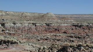
Had nice day
in Dinosaur N M, flowers about peak,
went to the canyon area,
north of
the S entrance. Visitor center S entrance closed except on weekends,
but bathrooms open.
 |
| Steamboat Rock from end of Harper Corner trail |
Left south visitor center at 5.25 pm, 1522
miles, 64F. had been cool all day, with showers to north
and east.
Dinner in Vernal at Cafe Rio, next to
Subway, south or east side of road. Very good. Eat there again.
5.29.2013 9:25 am mountain/ 8:25 pdt 60 F
1840
mi, left Wendover after overnight stay at Quality Inn, reasonble room rate. Note
that time zone changes at NV border. Arrived last night at about 11:45 pm mdt.
EB had to drive through heavy rains in dark from Heber City over the pass to
SLC which was no fun. Road work, lines on road almost invisible. Got gas at exit 124 in SLC, This a good stop at that hour
of night.
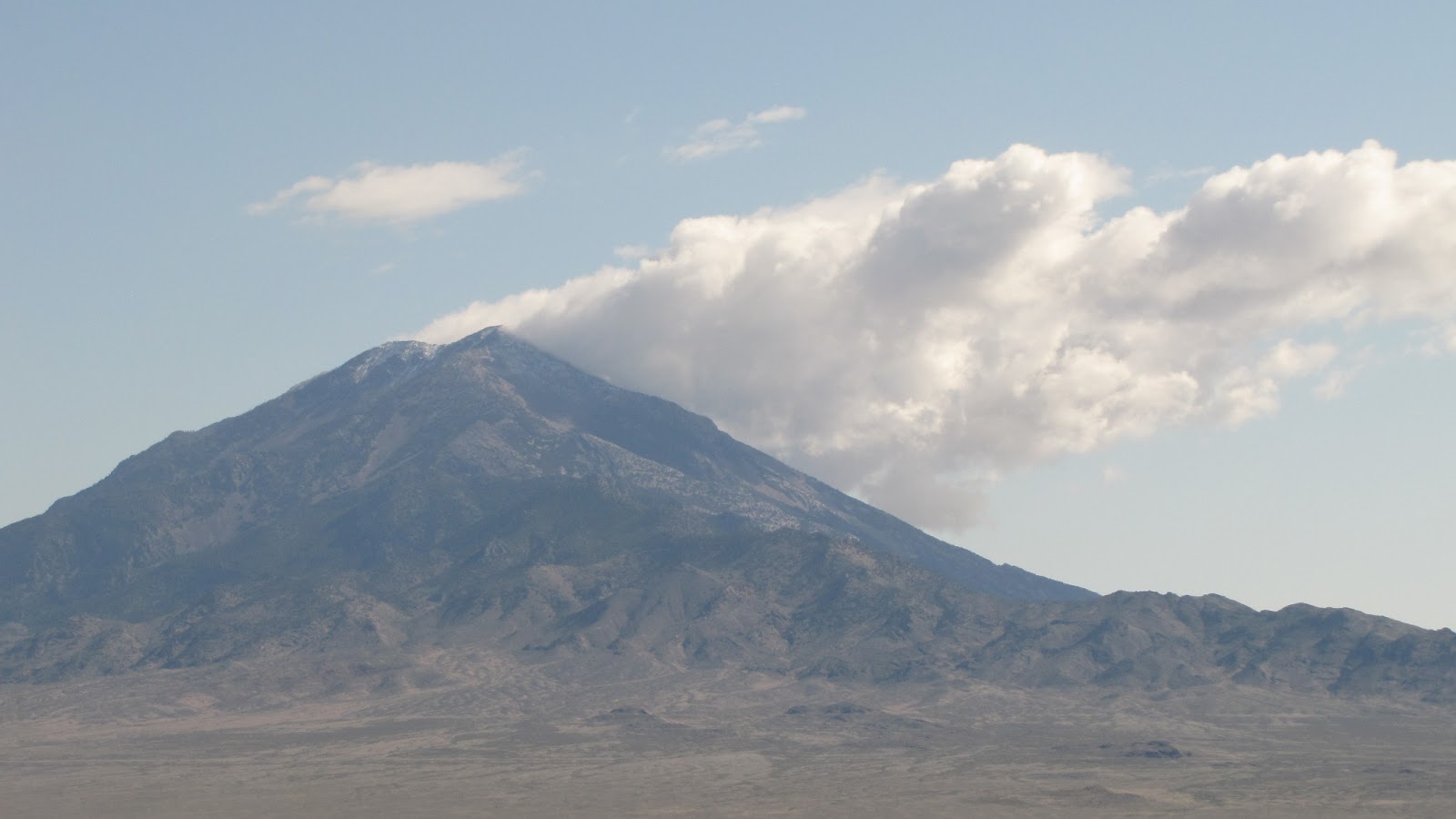 |
| Another Pilot Peak, this one in Nevada |
75 F, 1 pm PDT 1966 miles, leaving beautiful
California Trail Interpretive Center, Elko,
NV
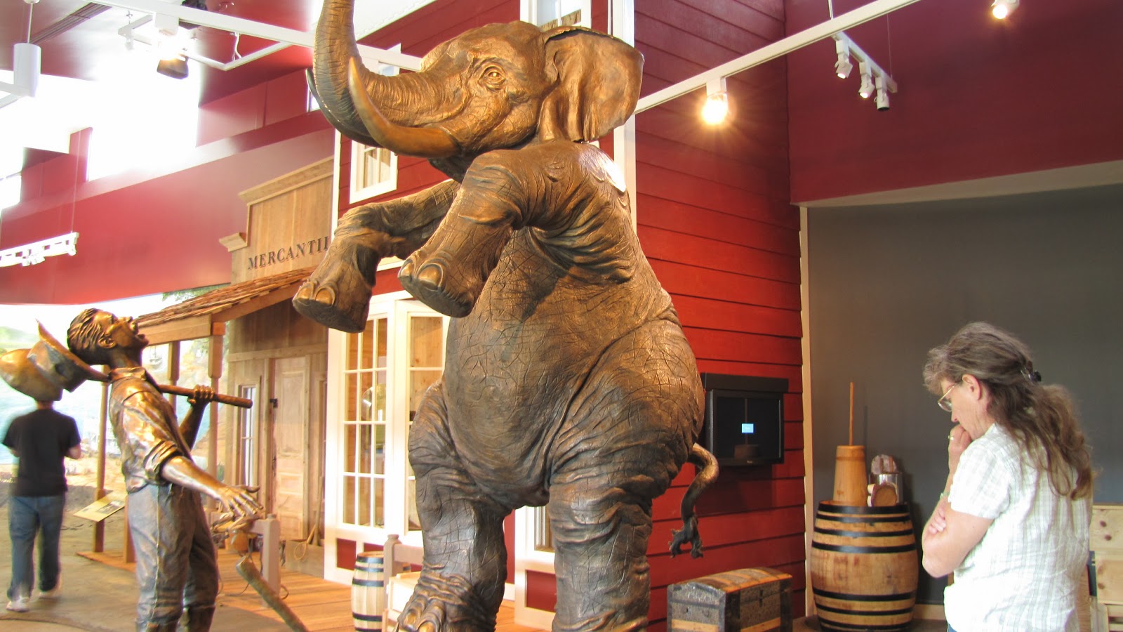 |
| Spent a lot of time at the California Trail California Trail Interpretive Center, Elko,
NV, indoors and out. |
Mi 2070 3.10 pm 72 F finished lunch at rest
area just east of Winnemucca.
Gas at Lovelock. 4.25pm miles cleared by mistake at 2150.
45642 odometer,
45774 53 F 6.45pm to 7.55pm hike at Castle Peak
trailhead. Walking over a few remnant snow piles.
 |
| We saw lots of beautiful scenery on this trip, but I always think its hard to beat the Sierras. |
Dinner in Auburn 9 pm from Subway ate in
parking lot of Bel Air grocery. North of freeway on hwy 49. On road again at
9.40.
Used 1.39 GB of data on the jetpack.
Return 10.45 pm, end odometer 45898
So total miles return trip = 2150+(45898-45642)=2406


